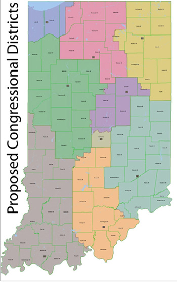
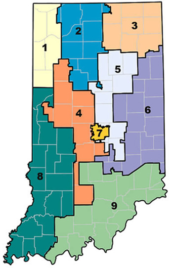
 State lawmakers are required to redraw district boundaries once every 10 years to reflect population changes recorded in the census. This allows for a statewide compliance with the "one-person, one vote" principle, which was established as part of the Voting Rights Act of 1965. The redistricting process this year will reshape the Indiana General Assembly’s House and Senate districts as well.
The GOP proposal calls for LaPorte County, a Democratic stronghold, to be split between the Second District and the First District, which otherwise consists of Lake and Porter counties. LaPorte County was key in Donnelly's narrow win over Republican Jackie Walorski in last year’s election.
Senate President Pro Tem David Long, R-Fort Wayne, told reporters the proposed congressional districts are more compact and more representative than the current districts. He added that political considerations weren't as important as keeping counties together.
Nine of the state's 92 counties would be divided between two congressional districts under the proposed plan. The other 83 would be single-district counties.
 State Democrats have also released a proposed Congressional redistricting map, under their "Good Government Plan," which can be seen at: http://www.in.gov/legislative/senate_democrats/files/redistricting/maps/Cong.Districts.pdf
State Senator Tim Lanane (D-Anderson), the Ranking Democrat on the Senate Elections Committee and the caucus lead on redistricting, said the Good Government Plan adheres to three primary principles: compactness, communities of interest and competitiveness. Lanane said proposed maps are based on a regional approach with an emphasis on logical boundaries and keeping neighborhoods, towns and other communities together.


